As an early practitioner of drone-based land surveying and 3D laser scanning in Armenia, an engineering geodesy and surveying expert helped teams handle difficult terrain with greater precision and less delay, offering a practical model for better construction decisions
Commercial drone registrations now account for 37% of all active units, signaling a decisive transition from recreational use to industrial necessity. Within this professional surge, the ability to maintain project momentum on difficult terrain remains a critical competitive advantage.
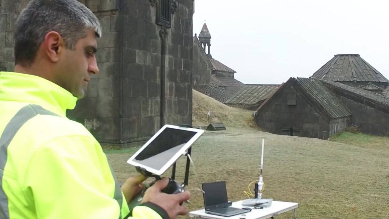
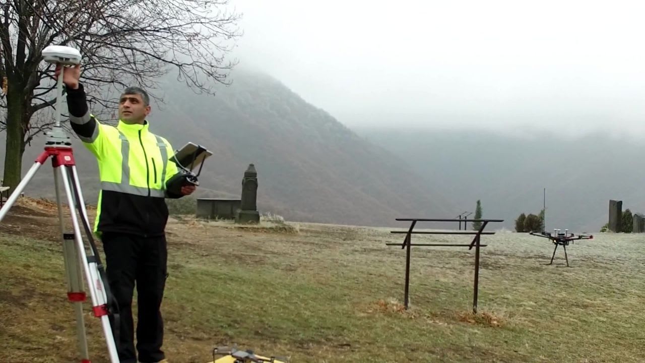
Hovhannes Ter-Isahakyan, a survey engineer specializing in geodesy, cartography, and 3D LiDAR aerial laser scanning, has addressed that problem by building a faster surveying workflow for large, difficult sites that combines UAV photogrammetry, LiDAR capture, terrain modeling, and engineering deliverables for mining and infrastructure projects. With more than 20 years of experience across civil, mining, road, and hydraulic engineering, he co-founded GeoDesign LLC, a geodesy and geology firm. He helped introduce drone-based land surveying and 3D LiDAR into Armenian practice early on, translating lessons from Armenia’s demanding terrain into expertise with broader international relevance.
Mountainous mining terrain exposes the limits of traditional surveying quickly. Sites are large, access is uneven, and the ground may be steep, forested, remote, or continuously changing under industrial use. In that setting, delays in survey work do not remain a narrow technical problem. They turn into a broader project problem, because engineers, planners, and site teams still need reliable topographic information while design and operational decisions are already moving ahead.
“Modern aerial surveying’s main value lies in the ability to obtain high-accuracy spatial data on forested land, in hard-to-reach terrain, and across open pits and mineral deposits without waiting for conventional field methods to catch up," the expert shares. On the sites Hovhannes worked on, he used UAV-based surveying to scan territories of roughly 500 hectares in about ten flights, with each flight lasting around ten minutes even in dense forest. By contrast, completing a comparable scope through traditional ground methods would have required a three-person crew and at least two to three months, allowing his approach to deliver usable site data far earlier in the project cycle.
The advantage is not only speed. Modern LiDAR-based capture also produces a far denser digital model of the terrain for engineering use. Depending on flight height and speed, the resulting surface model can contain roughly 100 to 300 points per square meter. By working with a system that could record up to 700,000 points per second, Hovhannes achieved a level of measurement density that traditional ground geodetic instruments cannot realistically match. That gave engineering teams access to faster deliverables and a more precise picture of the surface conditions on site.
He applied this technology across major quarry sites, mining operations, deposits, and difficult mountainous and forested terrain in Armenia, developing practical expertise that speaks to complex surveying challenges well beyond one market. The point was to turn site conditions into accurate topographic maps and digital terrain models ready for engineering use. In that sense, the value of modern surveying lies less in the capture itself than in its ability to produce usable technical intelligence before uncertainty spreads into the rest of the project.
“Traditional surveying is a physically demanding and time-intensive process. A ground crew has to move across large, uneven territory with geodetic instruments, establish control, measure point by point, and then spend significant time processing the results before engineers can use them. Teams have to work in harsh conditions for extended stretches of time. For the client, that translates into a costlier process with less flexibility and a longer wait for usable results,” he recalls.
Those constraints were not theoretical for Hovhannes. Before developing this direction he spent years leading the Surveying and Mapping Department at Vallex Group’s “Lernametalurgiai Institute” CJSC, where large mining and industrial projects made the limits of conventional surveying especially clear. Work across difficult terrain, active deposits, and infrastructure sites showed that project teams needed a faster way to turn field conditions into accurate engineering data. That experience became the practical starting point for his decision to bring new equipment and workflows into Armenian surveying. In 2015, in cooperation with Phoenix LiDAR Systems, he helped introduce UAV surveying and 3D LiDAR into Armenian practice. At the time, these tools had no local equivalent. That gave project teams a practical advantage on mining and infrastructure sites where speed, accuracy, and access were critical.
His experience also shows why adoption remained uneven even as UAV and LiDAR methods became more visible. Cost slowed wider uptake, while early practitioners continued receiving requests for consultation and technical support. The pressure point for the industry was workflow: capturing the data was only one stage. Teams also had to process it, verify it, and deliver it in a form engineers could use confidently and without delay.
As mining and infrastructure projects demand faster decisions, tighter coordination, and more reliable spatial data, surveying will increasingly be defined by how quickly teams can convert complex ground conditions into precise, engineering-ready outputs. By applying these methods early and demonstrating their practical value on difficult terrain, Hovhannes Ter-Isahakyan helped advance an approach that is likely to become more central to complex projects well beyond one market.
Comments
Loading comments…